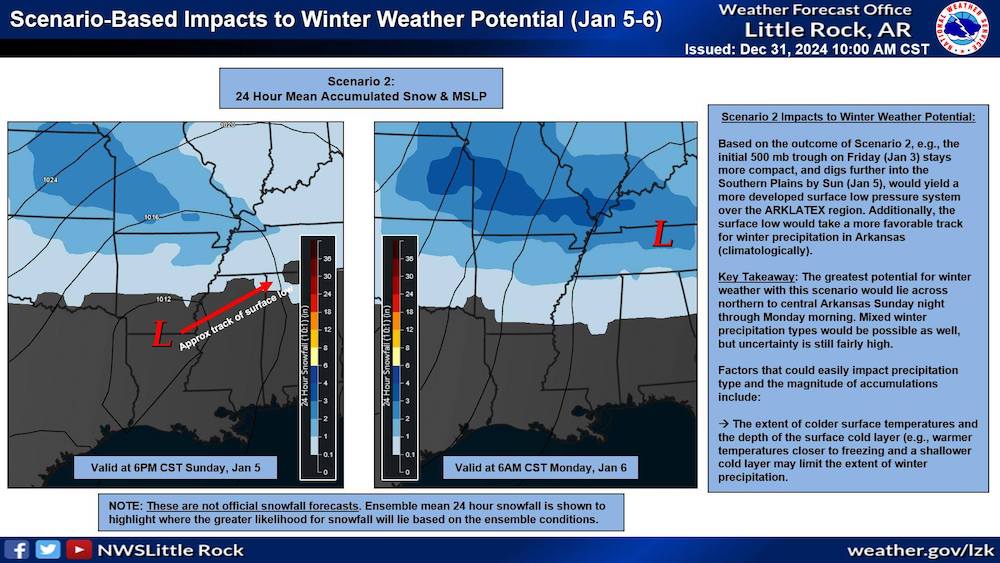
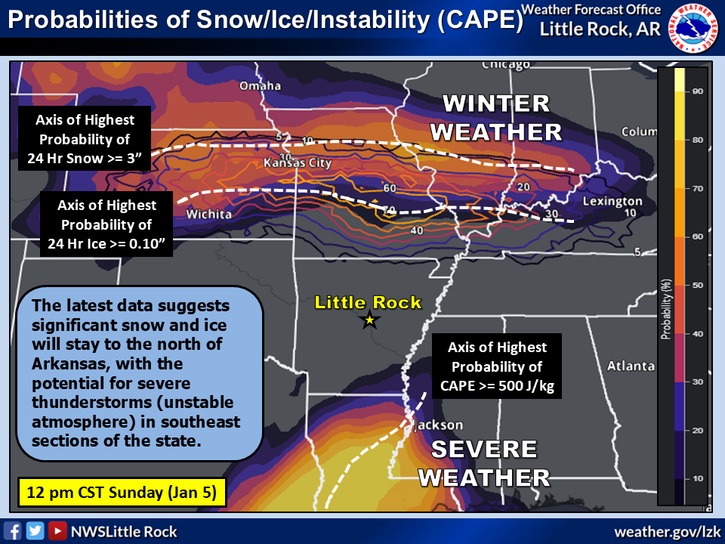
WARREN, Ark. – The National Weather Service (NWS) in Little Rock has provided an early look at a potential winter weather event impacting Arkansas early next week. According to the NWS, a developing surface low-pressure system could bring winter precipitation to parts of the state, including South Arkansas, on Monday, January 6.
The forecast scenario hinges on specific atmospheric conditions, including the positioning and strength of a low-pressure system expected to develop over the ArkLaTex region. Current projections suggest this system may bring snow or mixed precipitation, with the greatest potential for accumulation stretching from northern to central Arkansas Sunday night into Monday morning. However, colder surface temperatures and the depth of the cold air layer will play a critical role in determining the extent and type of precipitation.
For South Arkansas residents, the possibility of snowfall exists, but forecasters emphasize that uncertainty remains high at this stage. Warmer surface temperatures closer to freezing could limit significant accumulations in the southern parts of the state.
While the forecast is still subject to change as more data becomes available, the NWS urges residents to stay informed by monitoring updates in the coming days. If the low-pressure system takes a more favorable track for winter weather, it could mean impactful conditions for the region.
As of now, the NWS reminds Arkansans that this is not an official snowfall forecast but rather an early indication of where the greatest likelihood for winter precipitation may occur. Stay tuned to local forecasts as the situation develops.


