

Tonight
Cloudy, with a low around 36. Calm wind becoming north northeast around 5 mph after midnight.
Friday
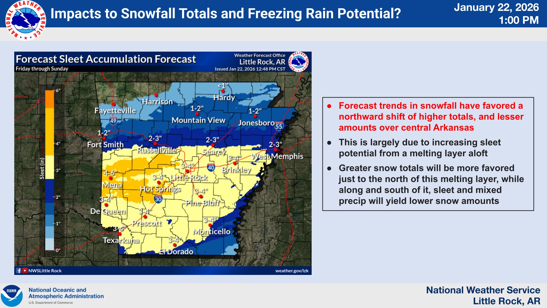
A slight chance of rain showers before 4pm, then a slight chance of snow showers between 4pm and 5pm, then a slight chance of sleet after 5pm. Cloudy, with a temperature rising to near 40 by 9am, then falling to around 33 during the remainder of the day. Northeast wind 5 to 15 mph, with gusts as high as 25 mph. Chance of precipitation is 20%.
Friday Night
A chance of sleet before 9pm, then sleet, possibly mixed with freezing rain. Low around 17. Wind chill values as low as 7. Northeast wind around 10 mph, with gusts as high as 25 mph. Chance of precipitation is 80%.
Saturday
Freezing rain and sleet. The sleet could be heavy at times. High near 19. North northeast wind around 10 mph, with gusts as high as 25 mph. Chance of precipitation is 100%.
Saturday Night
Sleet. Some thunder is also possible. Low around 13. North northeast wind 5 to 10 mph, with gusts as high as 20 mph. Chance of precipitation is 100%.
Sunday
Sleet, possibly mixed with snow showers, mainly before noon. High near 21. North northwest wind 5 to 10 mph, with gusts as high as 20 mph. Chance of precipitation is 80%.
Sunday Night
Partly cloudy, with a low around 4. North northwest wind around 5 mph.
Monday
Sunny, with a high near 29. North northwest wind around 5 mph becoming calm in the afternoon.
Monday Night
Mostly clear, with a low around 6.
Tuesday
Mostly sunny, with a high near 39.
Tuesday Night
Mostly cloudy, with a low around 21.
Wednesday
Partly sunny, with a high near 41.